Greenways are natural
corridors that help protect streams and water and air quality by keeping
development away from sensitive areas, like streams. Trails are often multi-use
for mountain biking and hiking. Some are paved for wheelchair access, and some
allow horseback riding as well. Most Greenway trails are fairly short .5 to 3
mile trips, although there are plans to link many of the Greenways into much
longer routes.
Raleigh and Cary have well-developed Greenways, mostly following the paths of major tributary streams. Some of the trails can be linked for longer hikes, although there is no camping except at a few designated sites in the states parks and recreation areas.
The Triangle Greenways Council is a trail advocacy group that works to develop and maintain area greenways. They hope one day to create the Circle The Triangle Trail, linking a variety of Greenways, bikeways, and other trails in Wake, Durham, Orange, Chatham, Johnston and Lee Counties.
Greenway Trail Maps & Descriptions (info is provided by Triangle Greenways Council)
The best trail resource for hikers
in the Triangle is provided by NC's
most experienced hiker, Allen De Hart,
Trails
of the Triangle :
170 Hikes in the Raleigh/Durham/Chapel Hill Area
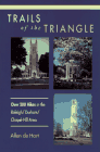
Paperback / Published 1997
William B. Umstead
State Park
Rt. 8, Box 130
Raleigh, NC 27612
(919) 787-3033
The park is situated between US 70 & I-40 near the Raleigh airport, between Durham and Raleigh, NC. The park has two major accesses - one is from US Hwy 70, and the other is from the Harrison Ave. exit (Exit 289) off 1-40. Another access is from Reedy Creek Rd., off Blue Ridge Rd., near the Art Museum.
There are 19 miles of easy to moderate hiking trails in the park, with 11 miles also designated as bridle and bike trails. Fishing and picnicking are also popular and there is a family campground for tents and RV's, along with two primitive campgrounds. Reservations are required for use of the primitive campgrounds.
The North Carolina Parks and Recreation system's Park Project has information about Wm. B. Umstead State Park. A map of Umstead State Park is available in Adobe PDF format (200K, requires Adobe Acrobat Reader),or as a jpeg (196 K).
Eno River State Park
6101 Cole Mill Rd.
Durham, NC 27705-9275
(919) 383-1686
There are 5 access areas - Few's Ford, Pleasant Green, Cabe Lands, Cole Mill and Pump Station. Park hours are 8 a.m. till dark.
Activities available include bird watching, boating, fishing, hiking, picniking and rock hounding. There are approximately 18 miles of hiking trails, mostly along the Eno River. Camping is available in the Few's Ford section.
The Eno River is one of the favored spots in the Triangle area. The river offers some small rapids to add a bit of challenge to a canoe or rafting adventure, although in the summer, you may walk more of the river than you float or paddle. As an added bonus, the Festival On The Eno brings some great musical entertainment to town for the July 4th weekend celebration along the riverside at West Point on the Eno.
The North Carolina Parks and Recreation system's Park Project has information about theEno River State Park. A map of Eno River State Park is available in Adobe PDF format (200K, requires Adobe Acrobat Reader),or as a jpeg (196 K).
The Eno River Association also has information about the Eno River State Park and the Festival for the Eno.
Lake Crabtree County
Park
1400 Aviation Parkway
Morrisville, NC
(919) 460-3390
Lake Crabtree County Park is 215 acres of
woodland, picnic and recreational facilities on the north side of 520 acre Lake
Crabtree, a flood control lake stocked for fishing. The park offers hiking,
biking, picnicking and playgrounds, boating, fishing and wildlife.
Picnic shelters can be reserved for up to 100
people by calling 919 856-6670. Unreserved shelters are up for grabs on a first
come-first served basis.
Several miles of hiking and bike trails offer
a little something for everyone.
- Old Beech Trail- .6 mile
interpretive trail for walkers. Highlights include a tree ID center and an old
sawmill site.
- Highland Trail- 3 loops for
hikers, joggers and bikers with several access points. This trail connects to
the Black Creek Greenway and Umstead State Park by using a section of the old
Lake Trail, which leaves from near the end of the parking lot for the boat
ramp.
- Entrance trail- .3 mile
- Loop 1- 1.3 mile
- Loop 2- .5 mile
- Loop 3- 1.3 mile
Blue Jay Point County Park
3200 Pleasant Union Church Rd.
Raleigh, NC 27614
(919) 870-4330
Hours: 8-sunset 7 days a week
On the south side of Falls Lake in N. Raleigh is Blue Jay County Park featuring hiking trails and the Blue Jay Center for Environmental Education. The Falls Lake Trail (below) is the highlight for hikers. Access is from the park itself, or at trail heads off Six Forks Rd. at the bridges crossing Falls Lake. The Center for Environmental Education offers a wide variety of programs year-round for all ages. Call for information on upcoming programs.
Hemlock Bluffs and Steven's Nature
Center
2616 Kildaire Farm Rd.
Cary, NC 27511
919 387-5980
Hemlock Bluff's is an isolated part of
the remnant forest ecosystem from the last ice-age 16,000-18,000 years ago. The
park's name comes from the small stand of eastern Hemlocks that survive in the
cool shade of ravine. Several trails are available in the park. The Steven's
Nature Center offers many programs for all ages as well as exhibits of the
local ecology.
| October til April | Mon.- Sat. 10AM to 7PM Sunday 1PM to 7PM |
| May til September | Mon.- Sat. 10AM to 5PM Sunday 1PM to 5PM |
South shore of Falls Lake State Recreation Area
At about 23 miles, the Falls Lake Trail is the longest nearly continuous trail in the area. It is part of the local route of the Mountains To The Sea Trail that will someday cross the whole state. This hiking-only trail roughly follows the south shoreline of Falls Lake north of Raleigh from the Falls Lake Dam westward to the Park Office at Hwy. 50. In places the trail is hard to follow and sometimes subject to flooding, and it is missing a few connecting sections. Check a topographic map, or Trails of the Triangle (above) for a more definite description of the trail.


